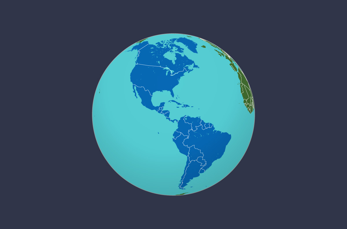
Here, you’ll find a map of the Americas, which includes North America, Central America, and South America. Each map is designed with different colored territorial divisions to distinguish one country from another. Below each image, there is a button to download the maps in PDF format.
Explore maps of other continents from this list:
Continent: Americas
The Americas is a continent located in the Western Hemisphere. It stretches from the Arctic Ocean in the north to the Diego Ramirez Islands in the south, and is bordered by the Atlantic Ocean to the east and the Pacific Ocean to the west. Due to its diverse geographical features, the Americas are divided into three distinct regions: North America, Central America, and South America. In the following maps, these three geographical regions of the American continent are detailed.

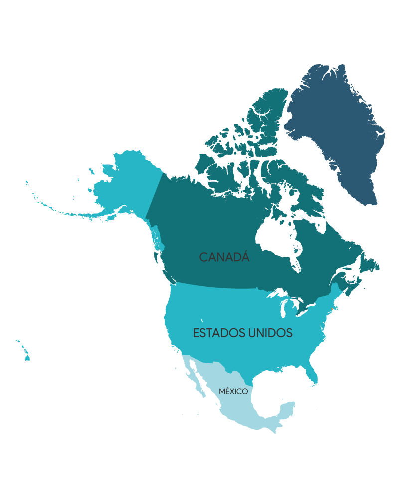
North America
North America is a region of the American continent, comprising three main countries: Canada, the United States, and Mexico. It is important to note that Alaska is one of the fifty states of the United States, and Greenland is a vast island belonging to Denmark. The following table details the countries and capitals of this region. You can download the PDF file with the same images shown below.
| Country | Capital |
| Canada | Ottawa |
| United States | Washington D. C. |
| Mexico | Ciudad de Mexico |

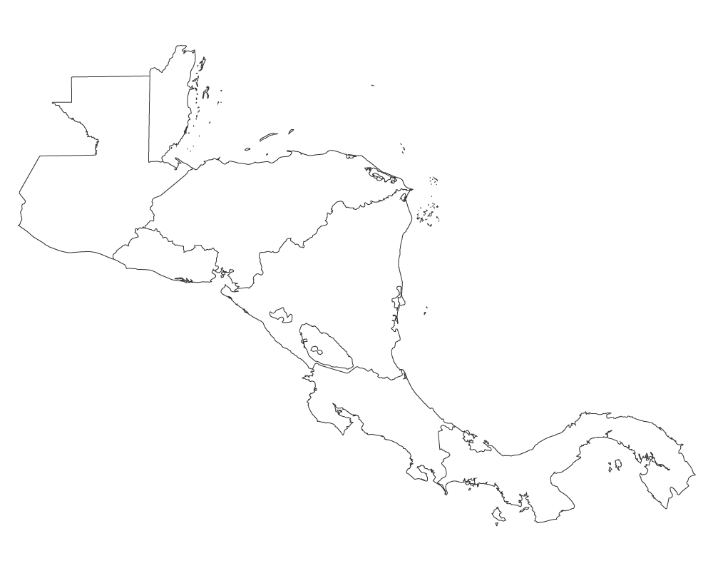
Central America
Central America is a region within the American continent, situated between North America and South America. Geopolitically, the countries that make up this region are Belize, Costa Rica, El Salvador, Guatemala, Honduras, Nicaragua, and Panama. Additionally, countries in the Caribbean are also considered part of this region due to shared history and culture. You can download the map of Central America using the button below, along with the accompanying images.
| Country | Capital |
| Belice | Belmopan |
| Costa Rica | San Jose |
| El Salvador | San Salvador |
| Guatemala | Ciudad de Guatemala |
| Honduras | Tegucigalpa |
| Nicaragua | Managua |
| Panama | Ciudad de Panama |

Centroamérica is a geographical region situated on the isthmus connecting North and South America, consisting of seven countries: Belize, Guatemala, El Salvador, Honduras, Nicaragua, Costa Rica, and Panama. Each country boasts its own unique history, culture, traditions, and tourist attractions. From Costa Rica’s tropical beaches to Guatemala’s Mayan ruins and Nicaragua’s picturesque colonial cities, Central America offers a wide array of experiences for travelers. If you’re interested in exploring the countries of Central America, discover everything they have to offer and fall in love with their beauty and diversity!

A map of Central America is a valuable tool for exploring and understanding the geography and politics of the region. This map showcases the seven countries of Central America: Belize, Guatemala, El Salvador, Honduras, Nicaragua, Costa Rica, and Panama, each with its name and capital city clearly marked. You can find this map in full color, highlighting distinct territories and borders, or in a blank version where you can customize it by adding your own labels. Additionally, there’s a version available without country names, perfect for studying and practicing the geographic location of each nation. Download the Central America map that best suits your needs and delve into the beauty and diversity of this unique region.

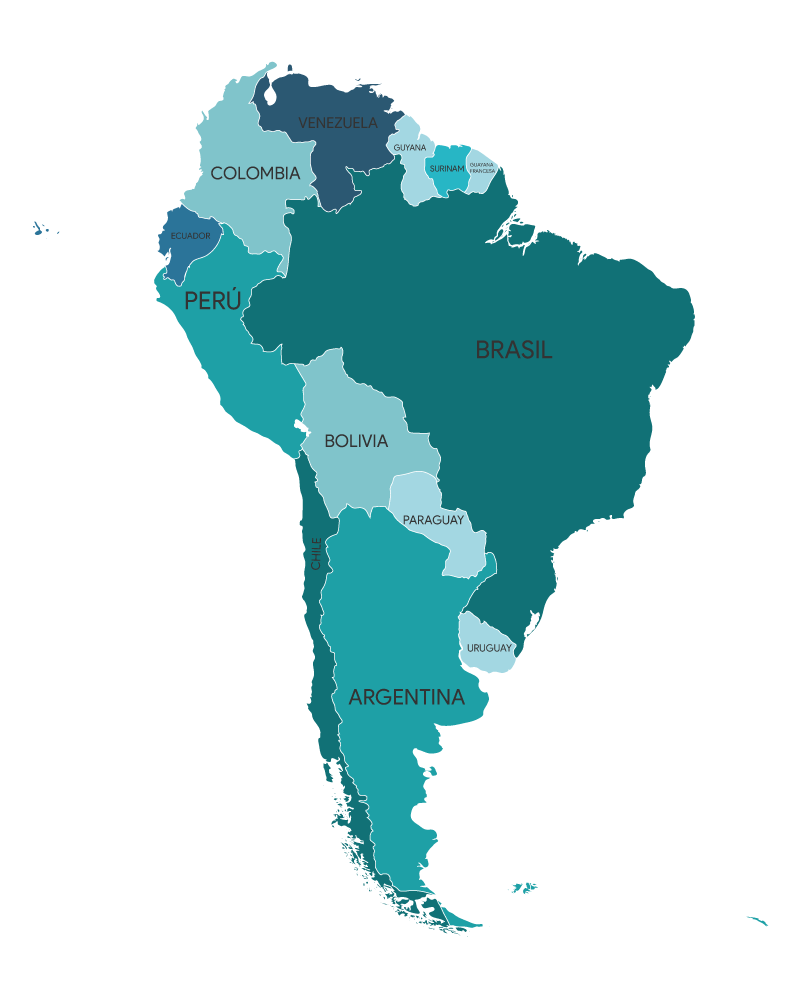
South America
South America, also known as South America, is a region of the Americas located in the southern hemisphere. It consists of 13 countries: Argentina, Bolivia, Brazil, Chile, Colombia, Ecuador, Guyana, Paraguay, Peru, Suriname, Trinidad and Tobago, Uruguay, and Venezuela. Additionally, there are overseas territories administered by other states, such as French Guiana under France, and five dependencies of other states. Each country is represented in the following maps, delineated by distinct colors. Remember, you can download the PDF of these images using the button below.
| Country | Capital |
| Argentina | Buenos Aires |
| Bolivia | Sucre/La Paz |
| Brasil | Brasilia |
| Chile | Santiago de Chile |
| Colombia | Bogotá |
| Ecuador | Quito |
| Guyana | Georgetown |
| Paraguay | Asunción |
| Perú | Lima |
| Surinam | Paramaribo |
| Uruguay | Montevideo |
| Venezuela | Caracas |

A map of South America is a valuable tool for exploring and understanding the geography and politics of the continent. This map features the twelve countries of South America: Argentina, Bolivia, Brazil, Chile, Colombia, Ecuador, Guyana, Paraguay, Peru, Suriname, Uruguay, and Venezuela, each labeled with its name and capital city. You can find this map in full color, highlighting different territories and borders, or in a blank version where you can customize it by adding your own labels. Additionally, you can download the map in a coloring version in both PNG and PDF formats, ideal for children and adults interested in exploring and learning more about the region. Download the South America map that best suits your needs and explore the beauty and diversity of this unique region.